

Stansted & Birchanger

The Proposals
Stansted & Birchanger
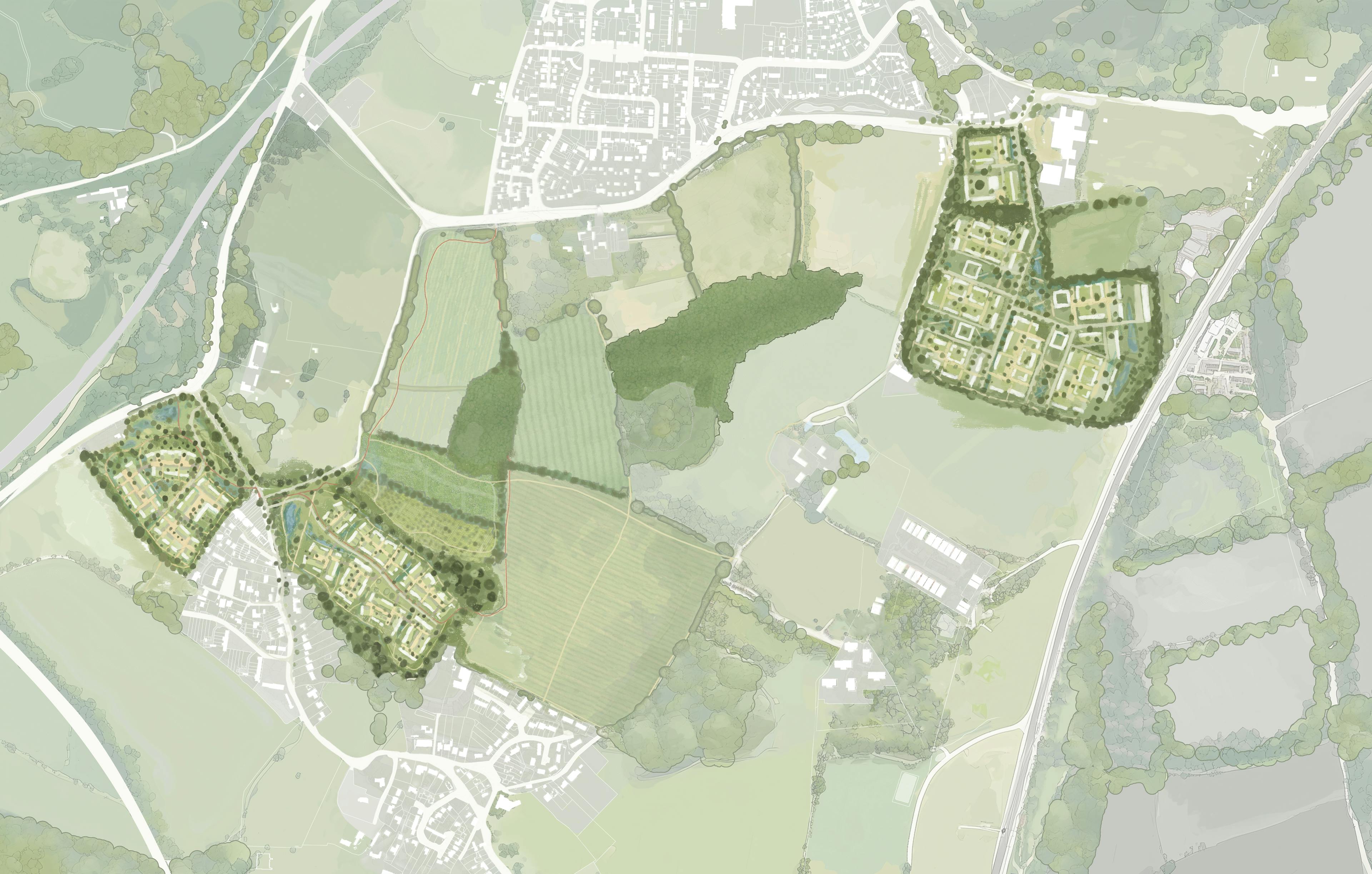
City & Country have submitted two planning applications, one for land to the south of Stansted Mountfitchet and one for land to the north of the village of Birchanger. The Stansted Mountfitchet site is located to the south of the existing village and is adjacent to Forest Hall School and Mountfitchet Romeera Leisure Centre. Immediately surrounding the site is Forest Hall Road, Parsonage Lane and Church Road, with Stansted Airport and the M11 to the east of the site. The Birchanger site is adjacent to Stansted Road (B1383), Birchanger Lane, Tot Lane, and borders the existing settlement.
BIRCHANGER
STANSTED MOUNTFITCHET
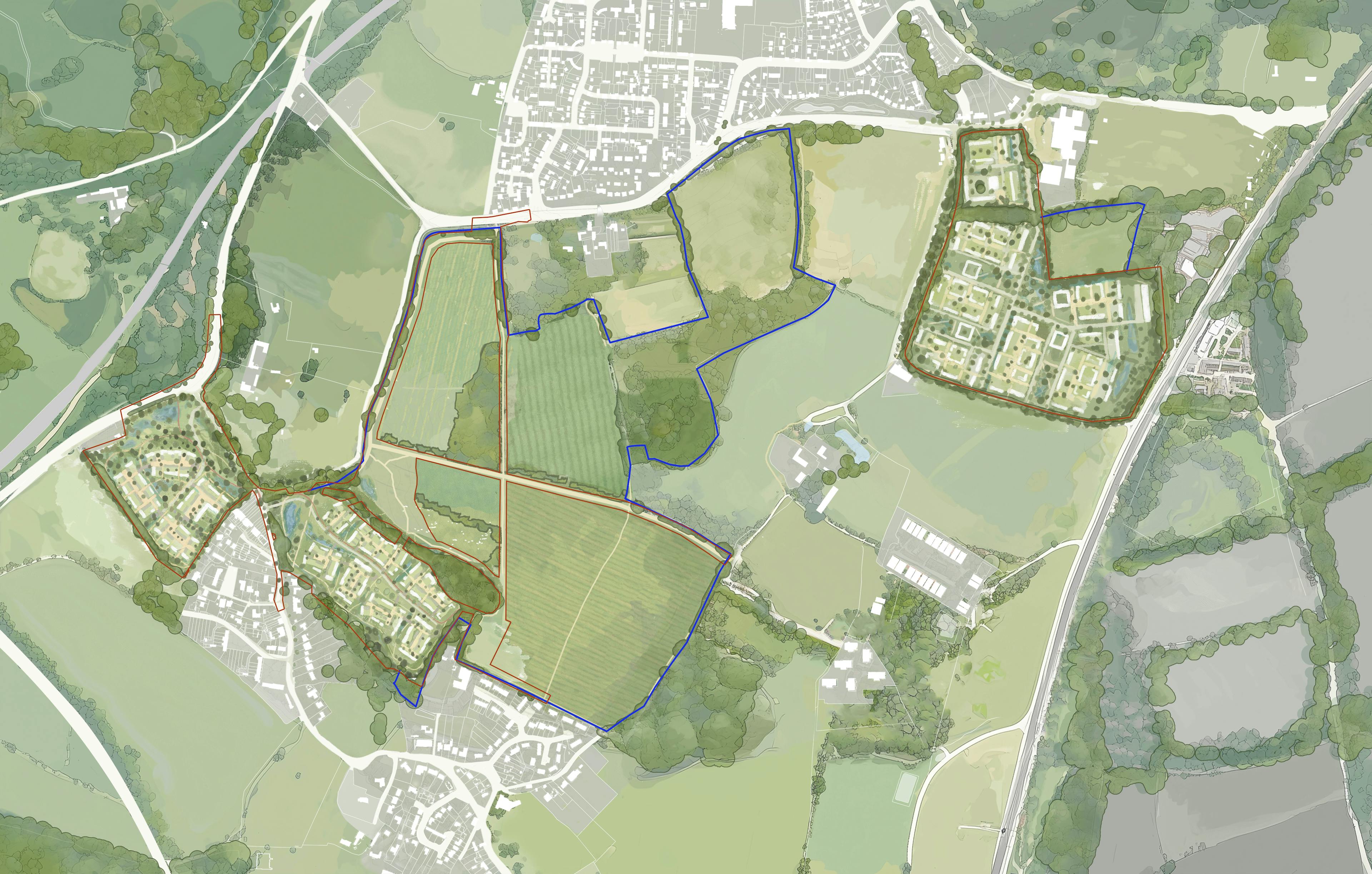
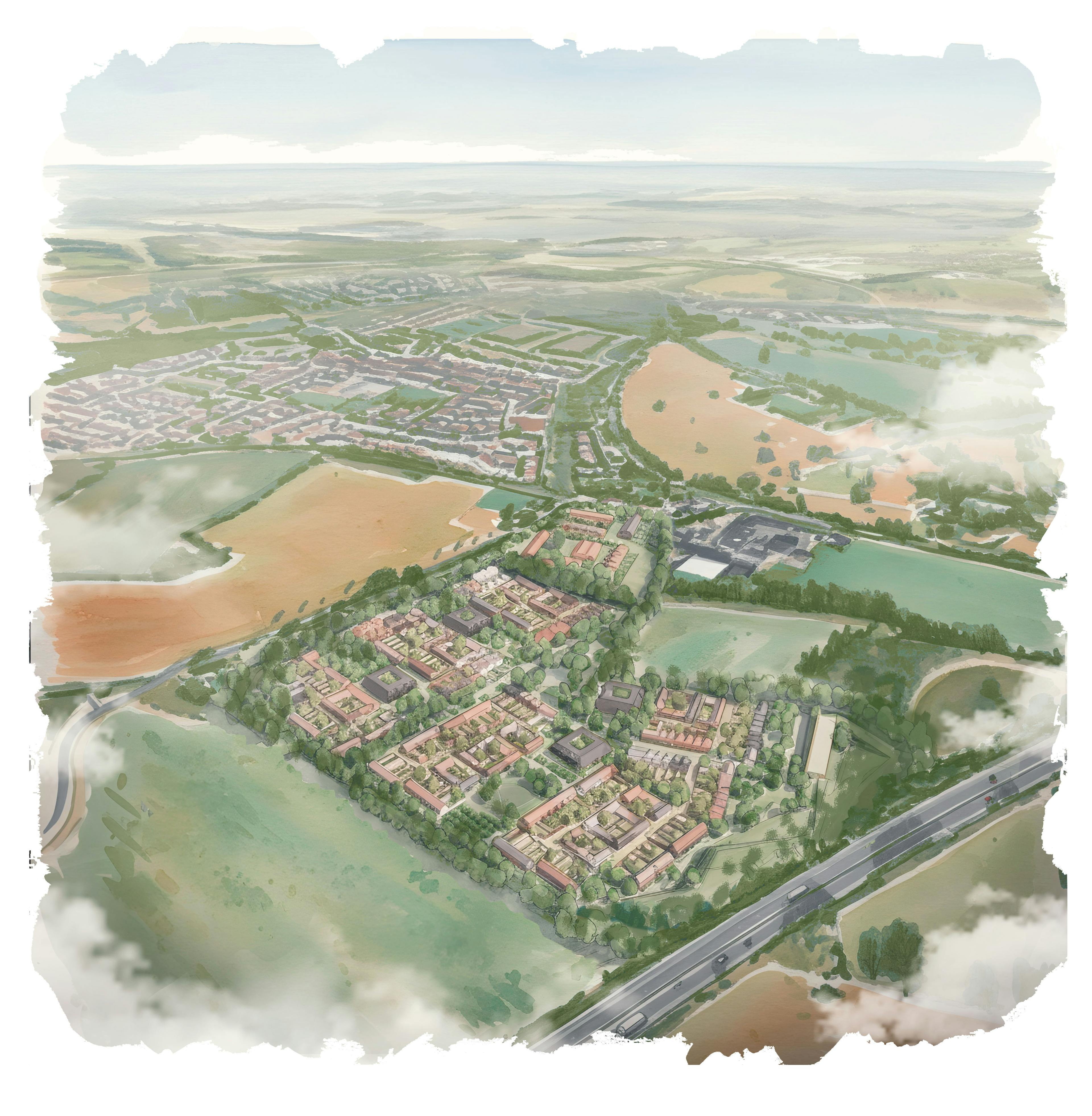
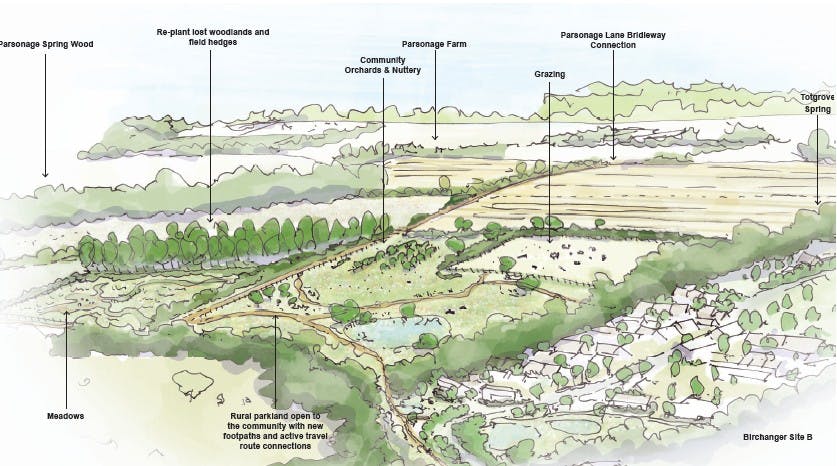
Land south of Stansted Mountfitchet
The proposed Stansted site is strategically placed in a sustainable location with strong transport links, local amenities including schools, healthcare provision and leisure facilities, and good connections to the centre of Stansted Mountfitchet and nearby town of Bishop’s Stortford. With convenient access to local bus stops and to Stansted Mountfitchet Railway Station, the locations offers fast links to both London and Cambridge. The centre of Stansted Mountfitchet, with its railway station, shops and health centre is 15 minutes walk and 5 minutes cycle from the site. Stansted Airport is 15 minutes away by bus, or 25 minutes away by bike. There is a secondary school and leisure centre adjacent to the site.
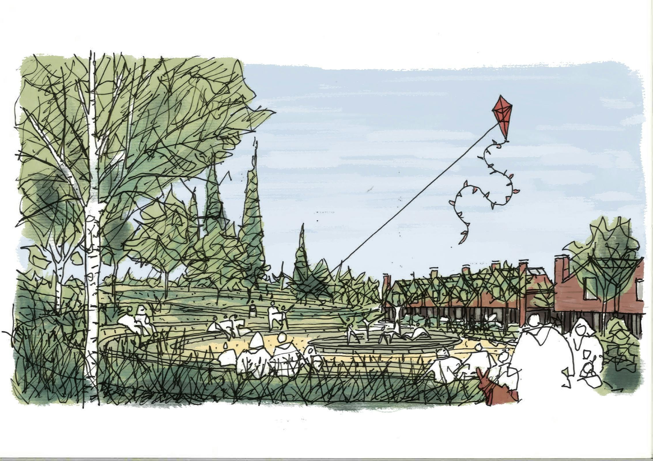
150 private homes, 150 affordable homes and a care home are proposed, as well as small cluster of local facilities including a shop, café, nursery, shared workspace, and gym - ensuring that daily needs can be met without reliance on car travel. In addition, land is allocated for the potential expansion of Forest Hall Secondary School and for a village hall for Stansted Mountfitchet. The development will also include additional play provision and new green spaces that the existing and new residents of the village will be able to enjoy. All the homes will be built to Uttlesford’s emerging policy to have net zero carbon operational energy usage.
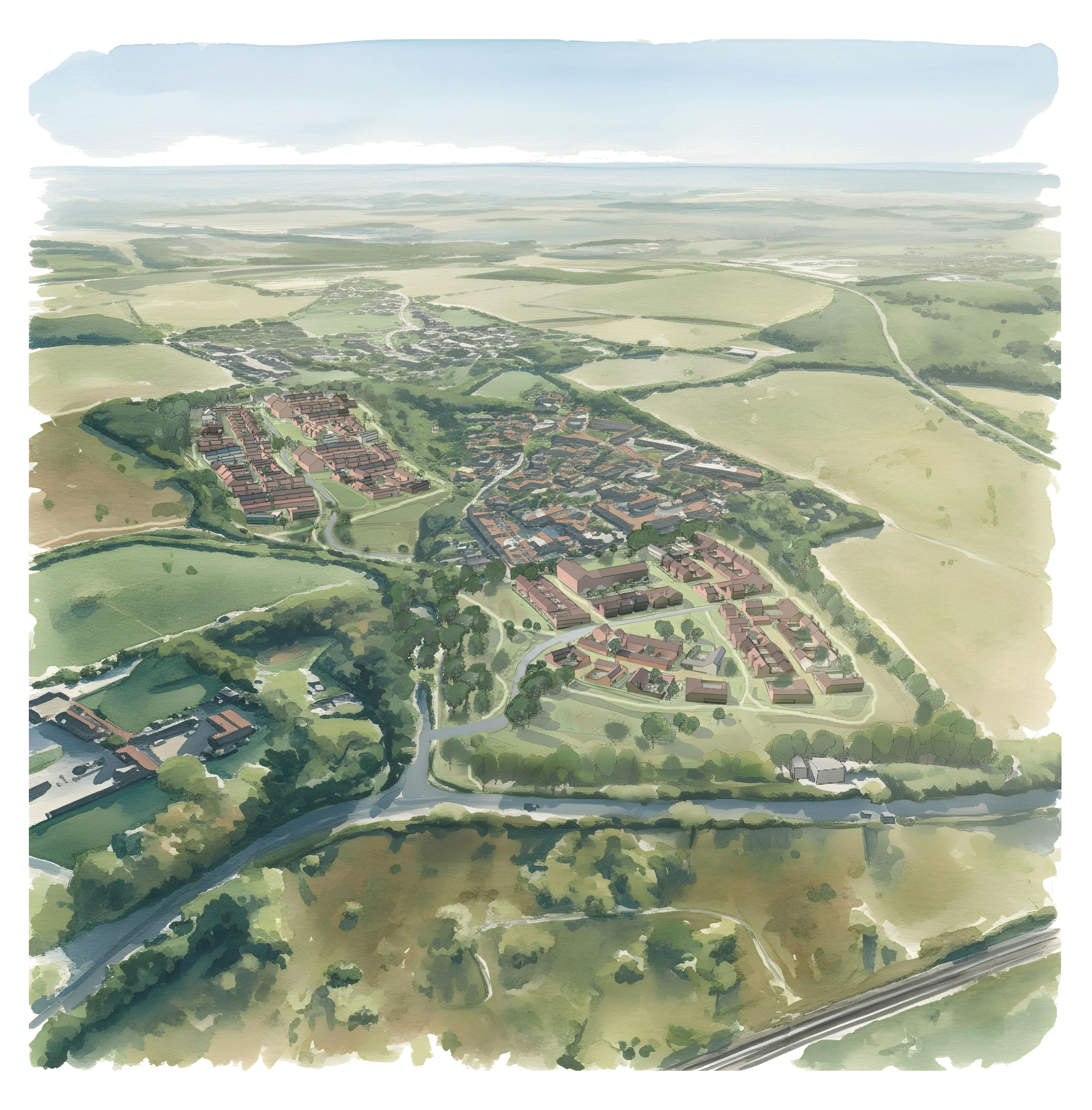
Land north of Birchanger
The proposed Birchanger site is located close to transport links and local amenities such as a pub, sports & social club and primary school. The sites’ sustainability will be ensured by the provision of improved pedestrian and cycle links to local bus stops, Stansted Mountfitchet to the north and Bishop’s Stortford to the south, as well as improvements to the existing highway network. Stansted Mountfitchet Railway Station is 15 minutes away by cycle or 10 minutes by ebike and offers fast links to both London and Cambridge. Cycling to Forest Hall School would only take 6 minutes using our proposed improved cycle links, and Stansted Airport is a 22 minute cycle ride away, or 24 minutes by bus. There are allotments and a playground adjacent to the site.
90 private homes and 90 affordable homes are proposed, as well as new green spaces that new and existing residents can enjoy. Land is set aside should the primary school need to expand. The homes here will also be net zero carbon operational energy usage.
Green Gap
Further parcels of land between Birchanger and Stansted Mountfitchet are also in the ownership of City & Country. These parcels of land will be enhanced with the addition of new woodland and hedgerows, as well as new pedestrian and cycle routes to increase connectivity and encourage sustainable car-free travel. City & Country will also be applying to Natural England to create a large habitat bank between Stansted & Birchanger to provide significant biodiversity enhancement and conservation through the restoration of pastureland, lost woodland, lost hedgerows and other natural habitats. This will be legally protected and will prevent Stansted Mountfitchet & Birchanger coalescing. The proposals will significantly enhance the biodiversity of the land significantly increasing habitat for wildlife.
Vision for the Site
City & Country
City & Country are a local business to Stansted, having based their head offices there for over 20 years, they are proud to have worked with the local community over the years as a local employer, award winning developer and charity supporter. Many of their staff live in Stansted and the surrounding towns and villages of Uttlesford.
For the last 20 plus years City & Country have focused on conversion of large heritage buildings, such as Balls Park in Hertford, St Michaels in Braintree and the Galleries in Brentwood. They also work further afield with King Edward VII Estate in Midhurst and sites in London, Bath & Bristol. In the last 10 years they have expanded into development of new homes in Essex, initially West Field at St Osyth, and more recently Manningtree Park in Lawford. Projects range from developments of 50 to 500 homes.
The early work on the conversion of historic buildings and their surrounding landscape has taught them to look very carefully at the heritage and context of a site and develop schemes that are rooted in the history of the area and respond positively to their surroundings. The business is family owned and employs more than 150 people.
The opportunity to develop land so close to their offices, where many of their staff live, is an opportunity to create a scheme that responds to the local character, area and culture in a positive way. They wish to set a new standard for exceptional design in Uttlesford. If the planning application is successful City & Country intend to deliver all of the new homes themselves, the scheme will be highly sustainable and provide much needed affordable and private housing for the area.
Consultant Team
City & Country have employed the Stirling prize winning architect Fielden Clegg Bradley Studio to design the village extensions in conjunction local landscape architects Dutch Landscape Studio. Stirling Prize-winning FCBStudios was founded to move architecture forward. That’s why, for over 40 years, they’ve been pushing boundaries in sustainable, democratic, and socially responsible design. By grounding everything they do in research and constantly seeking out fresh perspectives, they balance beauty and functionality in every space they create.
Dutch create spaces that delight, excite and enhance the experiences for all those who inhabit, work, learn or play among them. Their award winning team of talented designers focus on working alongside nature and reflecting it’s continual transition – creating better places for all.

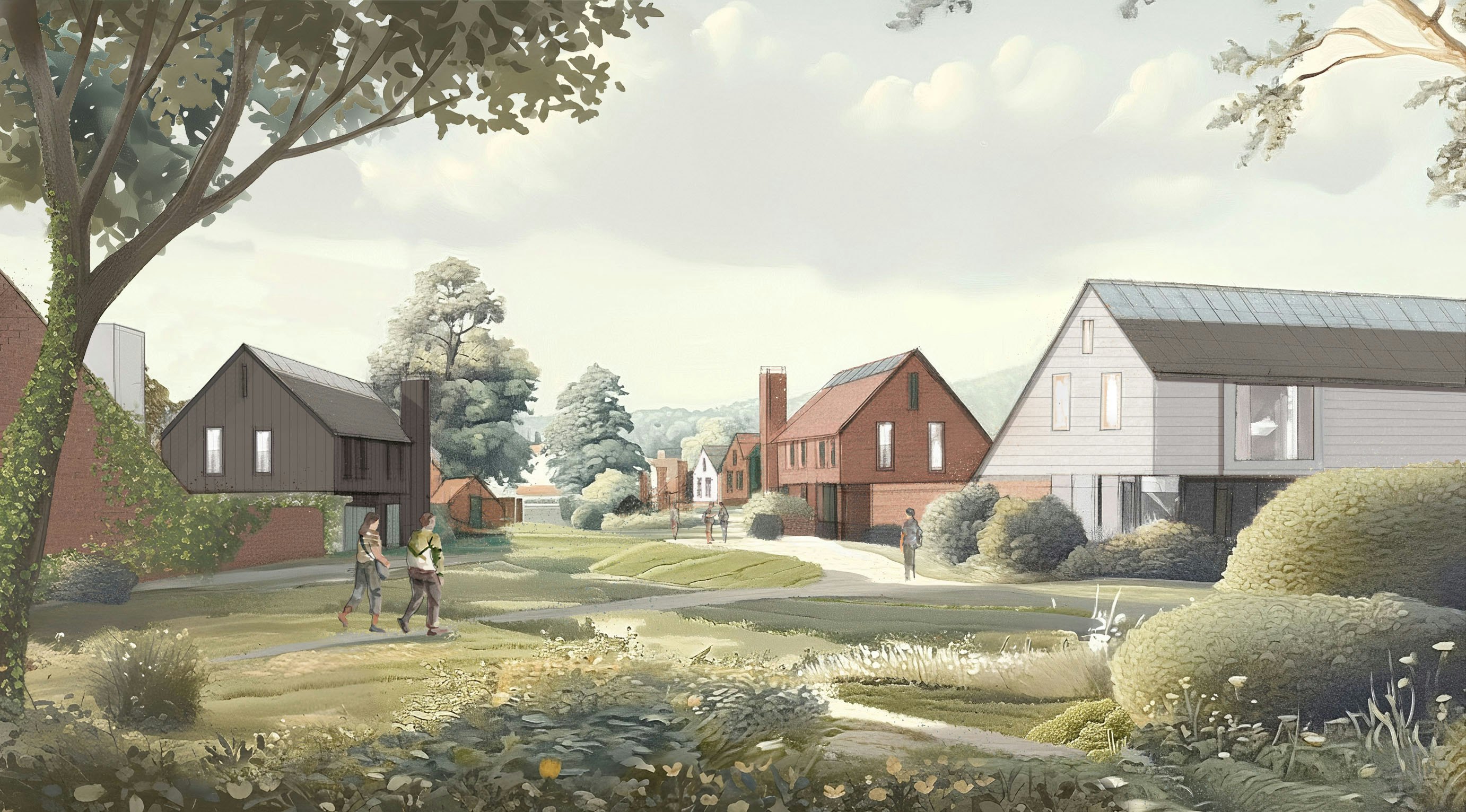
Vision
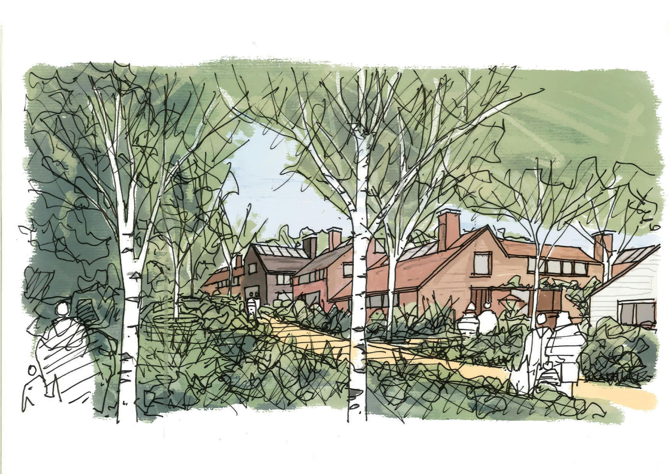
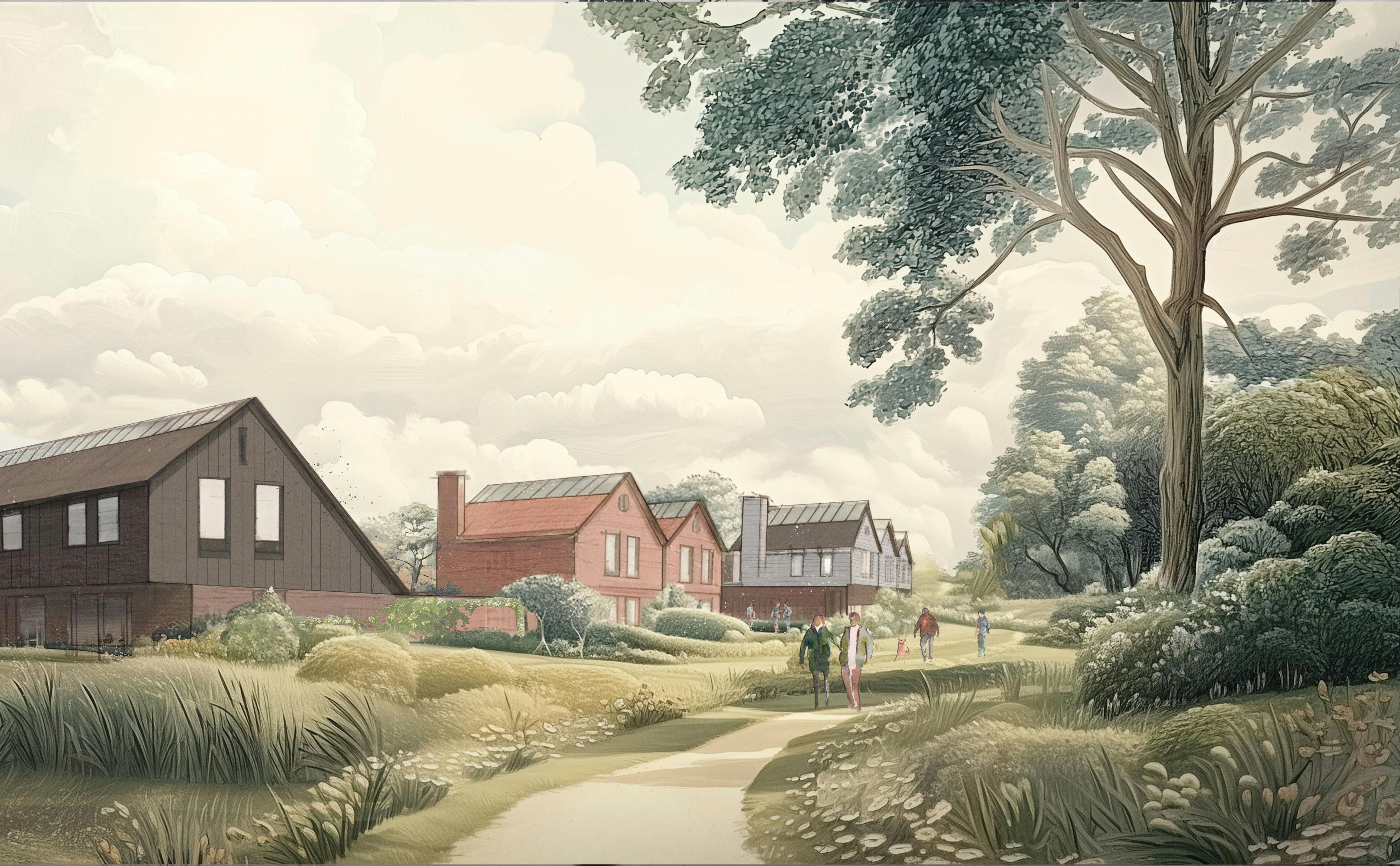
The vision for these sites is to create distinctive, contemporary rural communities that are intrinsically connected to the unique landscape of Essex. These are not merely places to live, they are environments that celebrate local character, nurture a sense of community, and enrich both ecological and visual quality. Each development should respond thoughtfully to its surroundings, drawing inspiration from the history, natural features, and cultural identity of the area.
- The proposals aim to be a trailblazer for modern rural housing which are defined here as clusters of homes surrounded by an immersive landscape.
- Each new village extension should respond directly to the topography, orientation, and outlook of each of the sites.
- The overall masterplan should actively create a series of appropriately scaled connected communities.
- The character of the homes should be a contemporary interpretation of the Essex vernacular houses and farmsteads.
- The historic character of Birchanger and Stansted and the surrounding villages should be expressed through the informality of the clusters of homes around lanes, greens and courts.
- All areas should be pedestrian dominated with car parking located on plot within parking courts and yards.
This vision has been developed into a series of parameter plans and a design code that set out how the sites should be designed and what rules must be followed to ensure this vision is met. The illustrations below show the different character areas and how the scheme will be developed.
Key Facts & Information
Stansted Mountfitchet site
150 affordable and 150 private homes as well as care home provision, shared workspace, shop, café, nursery and private gym.
4.77 acres of land allocated for Forest Hall School expansion and new village hall
14.73 acres of new public open space, that the new and existing residents of Stansted can enjoy
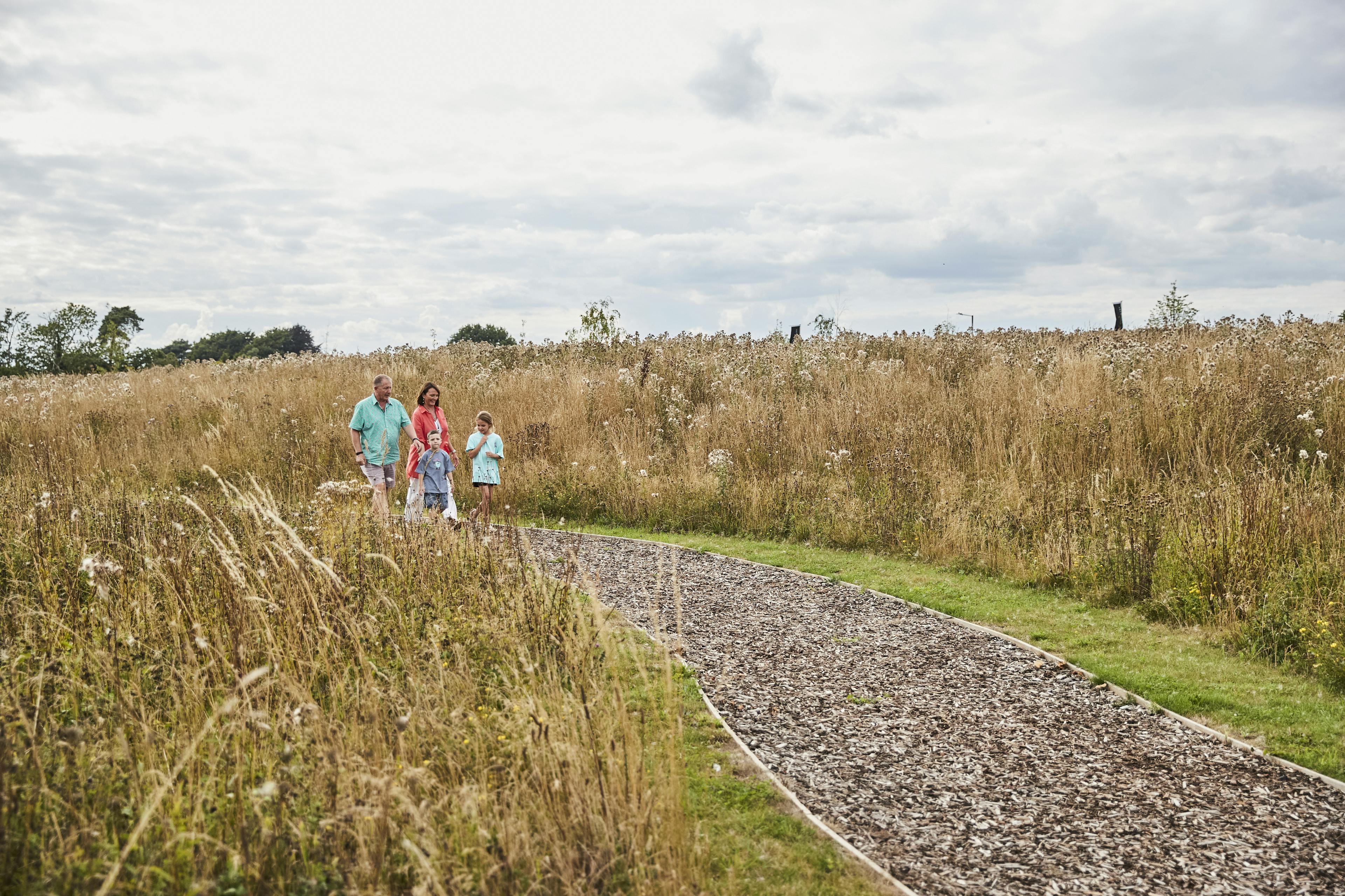
4 km of footpaths & cycleways
New pedestrian crossing adjacent to the site
New traffic lights and pedestrian crossing at the Forest Hall Road / Stansted Road junction
Landscaped earth bund and 50m gap from M11 to new homes to provide acoustic separation
Birchanger Site
90 affordable and 90 private homes
1.33 acres of land allocated for Birchanger Primary School expansion
15.77 acres of new public open space that the new and existing residents of Birchanger can enjoy
4 km of footpaths & cycleways
Traffic lights and pedestrian crossing at the Birchanger Road / Stansted Road junction
Traffic calming on Birchanger Lane including priority for cars leaving Birchanger to reduce rat running
Safe footpath link from Stansted Road bus stop to centre of village
Both Sites
Greater than 20% net gain in biodiversity
Net zero operational energy use from the homes
100% of homes provided with electric car chargers
Contribution to upgrading of A120 / Stansted Road roundabout
School places are available at both Forest Hall & Birchanger Primary Schools
Contribution to fund the closure of Tot Lane to vehicular traffic, enabling it to become a pedestrian & cycle route and protecting its historic character
Contribution to cycle route improvements towards Bishops Stortford
Green Gap
Approximately 100 acres of enhanced landscape with replanted woodland and hedgerows, with existing ancient woodland, trees and hedgerows protected.
Legally binding habitat bank to enhance biodiversity on site and prevent the villages joining together
9km of cycle ways and footpaths to enhance the linkages between Stansted Mountfitchet and Birchanger.
Planning Policy
The Application Site is in the Green Belt, but does not make a strong contribution to Green Belt purposes (a), (b) or (d). The Site falls under the
definition of Grey Belt land as set out in the December 2024 NPPF. This
concurs with the conclusions of the Planning Inspectorate in its pre-application
advice of 16 April 2025.
The proposals have been assessed and it is concluded the development on this site would not be inappropriate development in the Green Belt, as defined by
paragraph 155 of the NPPF: it utilises Grey Belt land; would not fundamentally
undermine the purposes (taken together) of the remaining Green Belt across
the area of the plan; there is a demonstrable need for the type of development
proposed; the development is in a sustainable location; and the development
would meet the Golden Rules of providing accessible open space, 50%
affordable housing and improvements to local infrastructure.
Further details on how this assessment is carried out are below:
The Presumption in Favour of Sustainable Development
Paragraph 11 of the NPPF states:
“Plans and decisions should apply a presumption in favour of sustainable development.
For decision-taking this means:
c) approving development proposals that accord with an up-to-date development plan without delay; or
d) where there are no relevant development plan policies, or the policies which are most important for determining the application are out-of-date8, granting permission unless:
i. the application of policies in this Framework that protect areas or assets of particular importance7provides a strong reason for refusing the development proposed; or
ii. any adverse impacts of doing so would significantly and demonstrably outweigh the benefits, when assessed against the policies in this Framework taken as a whole, having particular regard to key policies for directing development to sustainable locations, making effective use of land, securing well-designed places and providing affordable homes, individually or in combination.”
When Development is Not Inappropriate in the Green Belt
Paragraph 155 of the NPPF states:
“The development of homes, commercial and other development in the Green Belt should also not be regarded as inappropriate where all the following apply: The development would utilise grey belt land and would not fundamentally undermine the purposes (taken together) of the remaining Green Belt across the area of the plan;
There is a demonstrable unmet need for the type of development proposed;
The development would be in a sustainable location, with particular reference to paragraphs 110 and 115 of this Framework; and
Where applicable the development proposed meets the ‘Golden Rules’ requirements set out in paragraphs 156-157 below.“
Transport
The sites are both well connected to public transport, much more so than many other areas within the Uttlesford. The proposals also include various enhancements to the highways network to enhance safety and help deal with the additional traffic the developments will generate. These include:
- 16.85 km of pedestrian and cycle paths (“active travel routes”) proposals between Stansted & Birchanger to make it easier to connect between the villages
- Pedestrian crossing adjacent to Forrest Hall School
- Traffic lights where both Forest Hall Road and Birchanger Lane join Stansted Road as well as pedestrian crossings to the existing bus stops to make the junctions safer.
- Traffic calming on Birchanger Lane including priority right of way for cars leaving Birchanger to help limit rat running
- New footpaths from the Birchanger Stansted Road bus stop to City & Country sites and into the centre of the village as the current footpath to the main road is very narrow
- We are proposing a contribution to support the closure of Tot Lane, as this has very little traffic and would provide an attractive route for pedestrians and cyclists. If the closing of Tot Lane is not agreed, then we will provide a new cycle and footway parallel to Tot Lane within the green gap.
SCHOOL PLACES
Birchanger Primary School
- Currently Birchanger Primary School has 97 pupils, with a declared capacity of 117 pupils. Source - https://get-information-schools.service.gov.uk/Establishments/Establishment/Details/115127
- A standard one form entry school would accommodate 210 pupils (7 classes x 30 pupils).
- In addition, St Mary’s CofE Foundation Primary School currently has 262 pupils with capacity for 315, and Magna Carta Primary Academy currently has 201 pupils with capacity for 210.
- Our Birchanger proposals include up to 180 dwellings. Essex County Council apply a multiplier of 0.3 additional primary school pupils per new house, so this would equate to 54 new pupils. This would bring the total to 150-170 children (depending on whether you add to the current pupil numbers or the declared capacity of 117). Either way, that additional number is well within the 210 pupil threshold of a one form entry school.
- In terms of size of site, the current school site is c.1ha.
- There isn’t any guidance on size of a 1FE primary school, as they are not encouraged by Department of Education. As a guide, a 2FE school (for 420 pupils) is generally 2.1ha. so, proportionately, 1 ha would be able to accommodate full size one form entry school of 210 pupils. Nevertheless, our proposals include safeguarded land for expansion of the school if required.
Forest Hall Secondary School
- Forest Hall School has capacity for 660 pupils (four form entry), but currently only has 472 pupils (equivalent of three form entry), therefore there is a surplus of 188 pupil places. Source - https://get-information-schools.service.gov.uk/Establishments/Establishment/Details/141328
- The Department of Education preference is for secondary schools to be a minimum of four form entry (for viability and to offer a reasonable curriculum)
- In addition, there is Helena Romanes School at Great Dunmow which currently has a surplus of 339 pupil places and the new Avanti Grange Secondary School at Bishops Stortford (3km from Birchanger) which has capacity for 1,200 pupils and 297 pupils currently on roll.
- Essex County Council apply a multiplier of 0.2 additional secondary school pupils per new house, so this equates to 96 places for both the Birchanger and Stansted sites combined.
- Forest Hall School could comfortably accommodate all secondary school pupils from the Sites, and that is without parental choice and children going to private school being factored in; or the new school for 1200 pupils proposed at Takeley.
- The school site is c.5.5ha, which is currently over the size required for a four form entry school. Nevertheless, our proposals include safeguarded land for expansion of the school if required.
AFFORDABLE HOUSING
The number of households on the housing waiting list in Uttlesford, as at 31 March 2025, is 1,461. This has increased by 34% over the last six years according to the Local Government Inform website, based upon MHCLG figures, as shown here:
TOTAL HOUSEHOLDS ON WAITING LIST AS 31 MARCH 2025
2018/19: 1090
2019/20: 1108
2020/21: 1337
2021/22: 1272
2022/23: 1328
2023/24: 1461
The number of completed affordable homes delivered from 2018/19 to 2023/24 for Uttlesford is shown here:
ADDITIONAL COMPLETED AFFORDABLE HOMES
2018/19: 376
2019/20: 348
2020/21: 9
2021/22: 106
2022/23: 115
2023/24: 28
This means that the c.240 affordable homes being provided on these sites alone will provide more affordable housing than the whole of Uttlesford District has provided annually in the last four years.
Although the planning application is in outline, the proposed mix of affordable new homes is broadly in accordance with the Council’s indicative policy mix for Affordable Housing as set out in the emerging Local Plan for the first 35% (c.168 dwellings). The tenure split of that 35% will be 70% affordable/social rent and 30% home ownership. The additional 15% above the policy requirement (c.72 dwellings) will be low cost market housing, as defined in the definition of Affordable Housing as set out in Annex 2 of the NPPF. The overall affordable housing mix proposed for each site is as follows:
Ecology
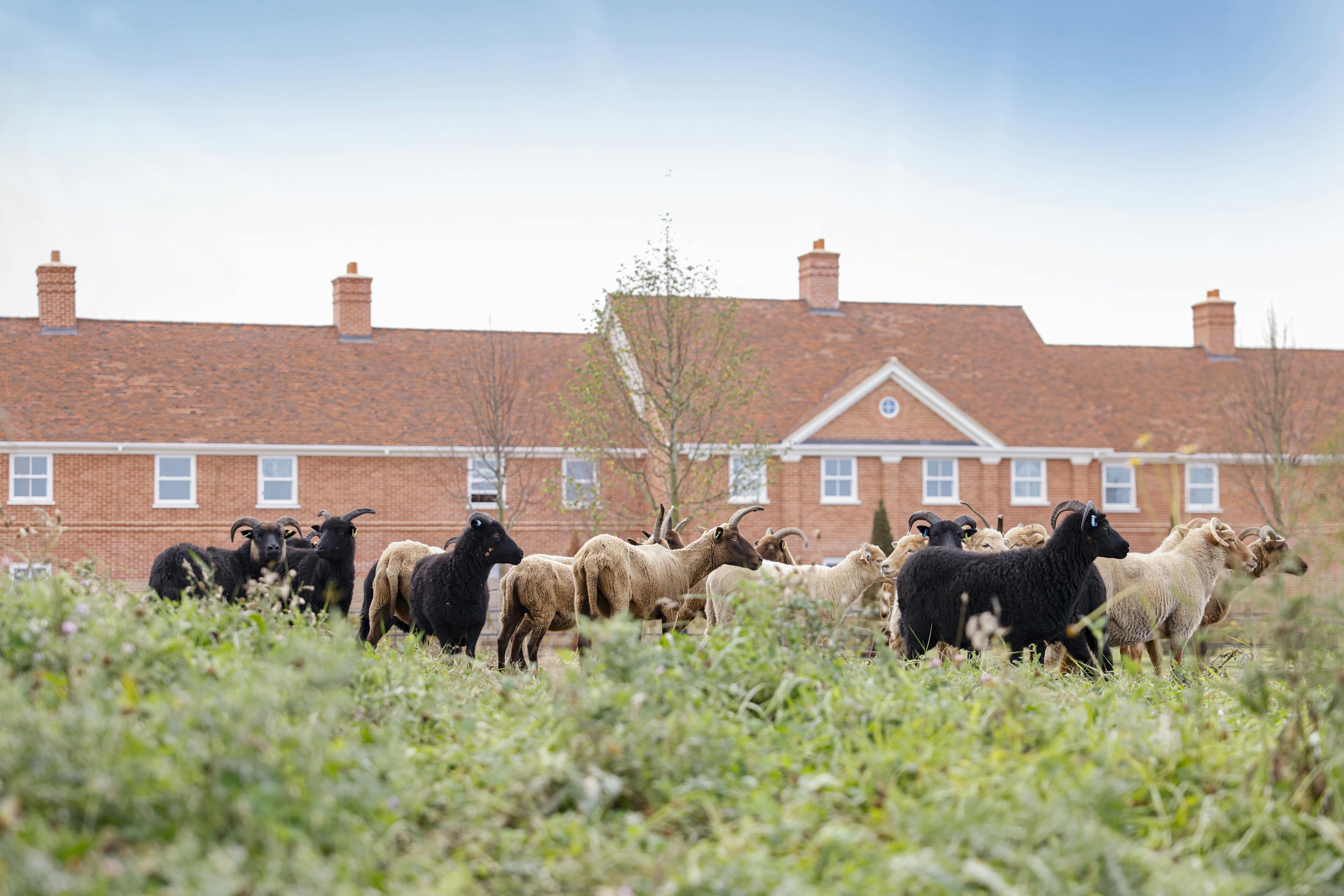
The sites contain areas of ancient woodlands and what remains of historic hedgerows as well as some very fine ancient trees. All of these elements will be retained and protected. Over the generations hedgerows and a woodland called Tot Grove have been removed and replaced with arable farmland, which is of low ecological value. We will be replanting these lost landscape elements, as well as providing new pastureland, orchards and a habitat bank. The habitat bank is an area of land that will be registered with Natural England and will be planted to enhance the biodiversity of the site and will be legally protected from development for a minimum of 30 years. The sites adjacent to Stansted Mountfitchet and Birchanger will also have the existing hedges and trees protected, and provide a significant biodiversity net gain of more than 20%.
Overall, the proposals will massively enhance the ecology on the sites and encourage native species to thrive and return to the landscape. The proposals will also enhance access to the countryside and provide residents with a better understanding wildlife in the area.
PROGRESS
Public Consultation
Two rounds of public consultation have been carried out, the first in November 2024 and the second in September 2025. These were centred around in-person consultation events, with the consultation material available to view and comment upon on a dedicated website.
Across both rounds of consultation, from November 2024 to October 2025, a total of 1,213 feedback responses were received via the multiple avenues made available for all to engage with. This includes 946 physical and online feedback submissions during the first round of consultation in 2024, 203 physical and online feedback submissions during the second round of consultation in 2025, 47 interactive map comments, and 17 emails received throughout the entire process.
Key themes of feedback received from the second round of consultation included concerns regarding the inadequacy of existing infrastructure and public services, traffic congestion, coalescence and overdevelopment, and concerns regarding the Grey Belt designation, of which have all been outlined in the feedback section of the submitted Statement of Community Involvement.
Some residents who provided feedback during the second round of consultation also shared remarks that were supportive or conditionally supportive of the proposals, acknowledging the need for new housing in Uttlesford, recognising the improvements made to the proposals and appreciating the community benefits and environmental measures proposed.
In addition to the above engagement, Shared Voice undertook a telephone questionnaire. They spoke to 108 residents living in Uttlesford district to get a community opinion snapshot exploring people’s attitudes to future housing needs of the area, the provision of new housing on this proposal and Land to the north of Birchanger and the types of facilities most important to the community.
The survey provided the following insights:
- Over 70% of those questioned think housing is not affordable in Uttlesford
- Two in three think more homes are needed
- Over 70% support at least half the homes being provided as affordable
- Discounted homes for first time buyers is seen as the most important affordable housing need
- Affordable housing should be prioritised for local people and key workers
- Two in five support the proposals
- Over 50% think the location is suitable for new housing
- Over two in three support the revisions made to the proposals
- Developers should prioritise road and parking infrastructure and educational facilities alongside housing.
Uttlesford Quality Review Panel
In September 2025 we presented our emerging proposals to the Uttlesford Quality Review Panel, made up of professionals in planning, design, landscape, transport and heritage. They concluded that:
‘the panel are encouraged by the direction of the scheme and commend the strength of the project team. There is confidence that if the current momentum is maintained, the project has the potential to deliver a high-quality outcome.’
Outline Planning Applications
The planning applications were submitted on 6th November 2025, and it is likely that Uttlesford will take a number of days to register the planning application. Once it is registered full details of the planning application will be available on their website, as well as details for how comments can be submitted.
You can view the applications by following the links below:
BIRCHANGER
STANSTED MOUNTFITCHET
Frequently Asked Questions
How many homes are proposed?
Up to 150 private and 150 affordable on the Stansted Mountfitchet site.
Up to 90 private and 90 affordable on the Birchanger site.
What forms of affordable housing are proposed?
The mix has not yet been decided, but it is likely to be a mix of affordable rent, shared ownership and discount market homes. At the public consultation there was a preference for homes for people with local connections.
Do we really need more homes?
The Government’s Plan for Change seeks to deliver 1.5 million new homes this Parliament to address “an inherited acute and entrenched housing crisis”.
Uttlesford has a recognised housing affordability problem. The Uttlesford Housing Market Report, December 2024 states that property prices in Uttlesford are higher compared to the average for the Eastern region due to the district's proximity to London and Cambridge. For example, the average price of a new build house is £453,457 for the Eastern region compared to £768,571 for Uttlesford. The average property price in Uttlesford in December 2024 was £564,920, while the median income of residents is £31,156. The government recognises that the supply of housing must be increased in order to make it more affordable.
There are over 1,400 households on the waiting list for an affordable home in Uttlesford, and this has increased by 34% over the past six years.
What will the impact on traffic be?
The introduction of traffic lights and pedestrian crossings will make the key junctions safer, and will also ease the flow of traffic leaving Forest Hall Road and Birchanger Road onto Stansted Road. The provision of pedestrian and cycle routes and amenities such as a shop on the Stansted site is designed to encourage people out of their cars.
Why are you proposing building on green belt land?
Uttlesford District Council’s new Local Plan is nearing adoption, but currently there is a housing shortfall in the district. Sites in sustainable locations like South of Stansted Mountfitchet and North of Birchanger can help the council deliver high-quality new homes in the short term to help reduce this deficit.
These sites fit into the new category of sustainable sites, known as Grey Belt, which the Government supports, but only if they meet certain criteria:
- To provide at least 50% affordable housing.
- To provide the necessary infrastructure improvements.
- To create or enhance accessible public green spaces.
The larger amount of affordable housing on these sites will help address the council’s rising housing waiting list of over 1,400 households currently, an increase of 34% in the last six years. The new market housing will help provide for the general housing shortage whilst also giving more choice to local people.
In February 2022, UDC was ‘designated’ by the Secretary of State as an authority not adequately performing its function of determining planning applications. As such, applicants could choose to submit major applications to the Planning Inspectorate. In accordance with this, City & Country sought pre-application planning advice from the Planning Inspectorate in early 2025 for development proposals. The Inspector concluded that the sites were considered to be Grey Belt, and that ‘if sites A and B [Birchanger] were to be developed then the remaining Green Belt would still adequately serve its five purposes in a meaningful way even considering the proposal for Sites F and G [Stansted Mountfitchet]’.
Will the proposals lead to the village of Stansted & Birchanger becoming one?
The schemes propose building on a small area of land that was registered as green belt in the 1990s. Uttlesford has 3,810 hectares of Green Belt land, and these proposals plan to build homes on 0.4% of this land. The land that is proposed for housing is screened by existing mature hedgerows and the view of the Planning Inspector is that building in these locations will not reduce the overall quality of the green belt.
City & Country owns 177 acres of land between Stansted & Birchanger, and are proposing to build homes on 22% of the land, on parcels adjacent to Stansted Mountfitchet and Birchanger respectively. The rest of the land between the settlements will be retained as landscape. Part of the land will be used to provide new cycle and pedestrian links between the two settlements, however the majority of the land will be turned into a habitat bank. A habitat bank is an area of land set aside for ecological improvement which is legally protected for a minimum of 30 years. This will prevent the settlements merging.
Building on one part of the green belt does not automatically open the door to building on the rest of the green belt.
Are there enough school places?
Essex County Council’s Education department will be consulted on our applications and using their forward planning and forecasting tools, will confirm whether or not financial contributions and / or land will be required from City & Country to provide for additional school places. There is currently capacity in the local schools, as detailed below:
Birchanger Primary School
- Currently Birchanger Primary School has 97 pupils, with a declared capacity of 117 pupils. Source - https://get-information-schools.service.gov.uk/Establishments/Establishment/Details/115127
- A standard one form entry school would accommodate 210 pupils (7 classes x 30 pupils).
- In addition, St Mary’s CofE Foundation Primary School currently has 262 pupils with capacity for 315, and Magna Carta Primary Academy currently has 201 pupils with capacity for 210.
- Our Birchanger proposals include up to 180 dwellings. Essex County Council apply a multiplier of 0.3 additional primary school pupils per new house, so this would equate to 54 new pupils. This would bring the total to 150-170 children (depending on whether you add to the current pupil numbers or the declared capacity of 117). Either way, that additional number is well within the 210 pupil threshold of a one form entry school.
- In terms of size of site, the current school site is c.1ha.
- There isn’t any guidance on size of a 1FE primary school, as they are not encouraged by Department of Education. As a guide, a 2FE school (for 420 pupils) is generally 2.1ha. so, proportionately, 1 ha would be able to accommodate full size one form entry school of 210 pupils. Nevertheless, our proposals include safeguarded land for expansion of the school if required.
Forest Hall Secondary School
- Forest Hall School has capacity for 660 pupils (four form entry), but currently only has 472 pupils (equivalent of three form entry), therefore there is a surplus of 188 pupil places. Source - https://get-information-schools.service.gov.uk/Establishments/Establishment/Details/141328
- The Department of Education preference is for secondary schools to be a minimum of four form entry (for viability and to offer a reasonable curriculum)
- In addition, there is Helena Romanes School at Great Dunmow which currently has a surplus of 339 pupil places and the new Avanti Grange Secondary School at Bishops Stortford (3km from Birchanger) which has capacity for 1,200 pupils and 297 pupils currently on roll.
- Essex County Council apply a multiplier of 0.2 additional secondary school pupils per new house, so this equates to 96 places for both the Birchanger and Stansted sites combined.
- Forest Hall School could comfortably accommodate all secondary school pupils from the Sites, and that is without parental choice and children going to private school being factored in; or the new school for 1200 pupils proposed at Takeley.
- The school site is c.5.5ha, which is currently over the size required for a four form entry school. Nevertheless, our proposals include safeguarded land for expansion of the school if required.
How can City & Country ensure they deliver on their promises?
Uttlesford District Council, in consultation with other bodies such as Essex Country Council and the NHS, will attach conditions to any planning permission to ensure the commitments made in our applications on aspects such as design, highways improvements and provision of open space are enforceable within set timescales.
In addition, a Section 106 Agreement which is legally binding will secure things such as financial contributions towards healthcare, education, and strategic highways improvements, where they are deemed necessary by the relevant authorities.
Will the proposals damage wildlife corridors and harm biodiversity?
No, quite the opposite. The proposals will restore lost hedgerows and woodland significantly enhancing the wildlife corridors on the site. Ancient woodland will be protected and not affected by our proposals. The proposals also include a Habitat Bank on top of the 20% plus net gain in biodiversity on the site. Overall, the scheme will significantly improve both wildlife corridors and biodiversity on the sites.
Will the scheme increase the risk of flooding?
No, quite the opposite – national policy means we cannot allow water to run off the sites at a greater rate than in their current state, and in fact we have to reduce the run-off rate further to allow for future increased rainfall as a result of climate change. This is assessed as part of the planning application, and the introduction of landscape features to retain water and regulate its release into the wider network ensures that there is no increased risk of flooding.
How does the scheme deal with the proximity to the M11 and airport?
An earth bund up to 10m high has been positioned adjacent to the motorway to screen the development from the noise of the motorway. This will be shaped and extensively planted to create a landscape feature. Air quality is assessed within the planning submission documents, with no adverse impact. The Stansted Airport flightpath runs parallel to the site therefore aircraft rarely pass directly over the site.
What will the impact be on local infrastructure and services?
The addition of more homes adjacent to Stansted and Birchanger will help support the existing cafes, pubs, shops and other businesses in the area by bringing in new customers. The shop and cafe proposed in the Stansted sites are a direct response from feedback at public consultation for the need for such facilities on the southern edge of Stansted. In addition, the proposed office space would provide the opportunity for people to work close to home in shared workspaces. The local schools currently have capacity, and additional pupils may attract increased funding for improvements. Any improvements required to healthcare, education or community facilities to accommodate additional users from the developments would be determined by the relevant authority and secured by the S106 agreements. Stansted is one of the very few villages of this size not to have a village hall, and allocating land for one to be built could really help with community events and functions.
How will the character of Stansted Mountfitchet and Birchanger be impacted by the proposals?
From historic origins, the sizes of both Stansted & Birchanger have changed significantly in tandem with new transport and employment opportunities. Stansted for instance trebled in the second half of the C19 and then trebled again in the C20. Birchanger has 1960s and 70s development which dictate the character of the village, infilling between the old farmhouses and church.
Stansted has distinct character areas based on the core settlements that have coalesced into the modern village. The Bentfield End, Chapel and Street areas have come together and are set apart from the Stansted Hall and Burton End settlements despite extensive recent development. The currently proposed development is set well clear of Stansted Hall which is well clear of the core settlement around Lower Street so will not have an impact on the character of existing settlement. The Birchanger development is set to the NW of the village and will not affect Birchanger Lane from the Cottage to the listed barn.
The new development is clustered as per the original settlement pattern of the area so grows out of the local vernacular and will not run into existing settlements in any way, physically or visually.
Does Stansted Mountfitchet railway station have capacity for more users?
Our proposals include walking and cycling routes to discourage car travel to the railway station. The station can accommodate 12-coach train services, and currently an average of 17.6 passengers uses each service, meaning the station ranks 696th of 1,735 stations for passenger to service ratio.